Posts tagged Hiking
Exploring Switzerland in 9 Days: An Active Itinerary for First-Timers
 
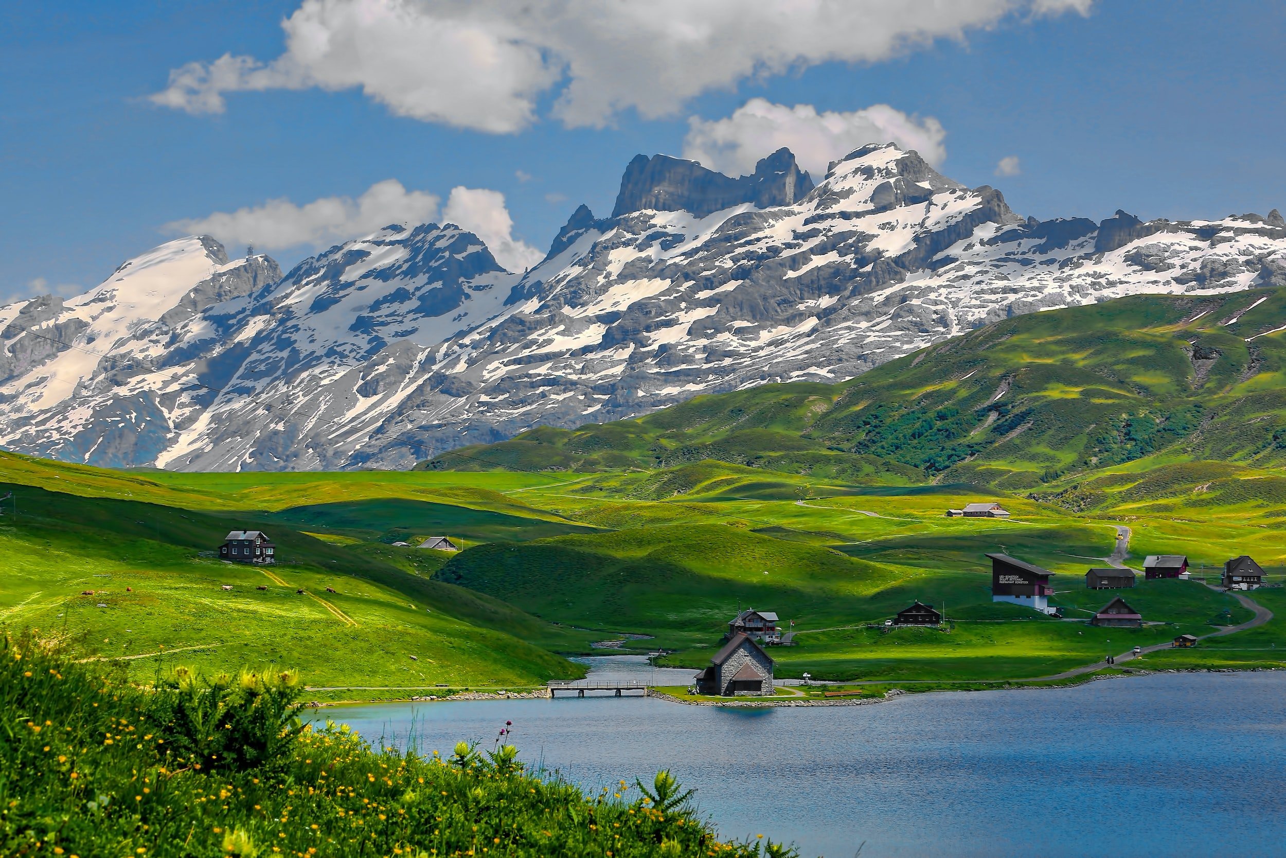
Alpine lake and green meadows below snowy peaks in Switzerland

Disclaimer: This post contains Affiliate Links for products I’m currently using. By using these links you won’t pay any additional fees, but support me to keep this site running!


SWITZERLAND ITINERARY: GENEVA, INTERLAKEN & JUNGFRAU, BERN & LUCERNE, ZURICH & ENGELBERG

Recommended 9-Day Switzerland Itinerary:

Lake Thun and Interlaken from a forested hillside

Geneva (1 night)

Interlaken (2 nights)

Bern (2 nights)

Lucerne (1 night)

Zurich (2 nights)

—

Total days: 9


Switzerland is known as one of the most beautiful countries in the world, and it’s no wonder why. From breathtaking mountains to crystal clear lakes, there are endless activities and sights to see while exploring this stunning country. If you’re planning your first trip to Switzerland, here is a 9 day itinerary that will help you make the most of your visit!

Day 1: Geneva

Start off your 9 day Swiss adventure by exploring Geneva, the second largest city in Switzerland. Take the opportunity to wander through its quaint cobblestone streets and admire its stunning architecture. There are also plenty of museums and galleries to explore if culture is more your thing. For example, take a tour of The United Nations Palace or immerse yourself in history at the International Red Cross and Red Crescent Museum. There’s also plenty of outdoor activities like kayaking or taking a boat ride on Lake Geneva. No matter what type of activity you’re interested in, there’s something for everyone in Geneva!
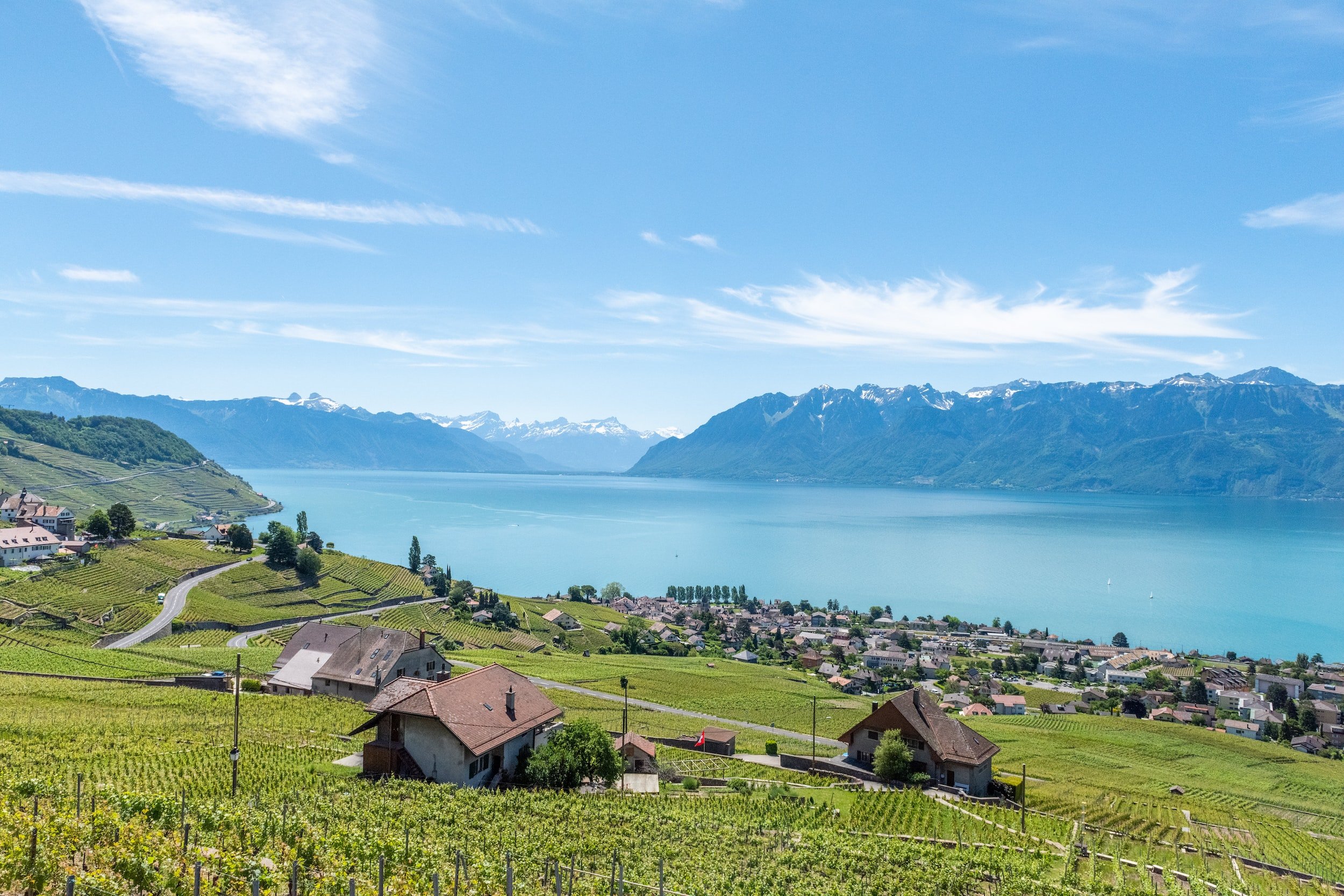
Lavaux vineyards above Lake Geneva in Switzerland

Day 2-3: Interlaken & Jungfrau Region

Next up on the itinerary is Interlaken, which is nestled between two glacial lakes - Thunersee and Brienzersee - making it an ideal spot for outdoor adventures such as paragliding, hiking or skiing during winter months. Be sure to take the train up to Jungfraujoch – Top Of Europe where you can experience breathtaking views from 11,333 feet above sea level. You can also explore some of the nearby glaciers including Aletsch Glacier and Eiger Glacier for an even more spectacular view! For dinner, try out Hotel Alpenruh’s restaurant which serves some amazing Swiss dishes with local ingredients. Afterwards, enjoy an evening walk around Lake Brienz before heading back to your accommodation.

Turquoise Aare River and flower boxes in Interlaken

Day 4-6: Bern & Lucerne

Following two days in Interlaken, it's time to move onto Bern – Switzerland’s capital city - where you can explore its well-preserved medieval Old Town with its picturesque cobbled streets and 15th century fountains. Don't miss out on visiting The Zytglogge – a clock tower built over 800 years ago which still rings out every hour!

After two days in Bern, head over to Lucerne; its charming old town with its colorful buildings along Lake Lucerne will make for some incredible photo opportunities! Spend a morning exploring Lucerne's Old Town area where you'll find landmarks such as Chapel Bridge and Water Tower as well as boutique shops selling handmade Swiss items like watches or chocolates. One afternoon, take a boat ride around Lake Lucerne for some lovely views of Mt Pilatus and Mt Rigi in the distance before grabbing dinner at Restaurant Weinstube Höfli which serves delicious Swiss-German cuisine with Italian influences.
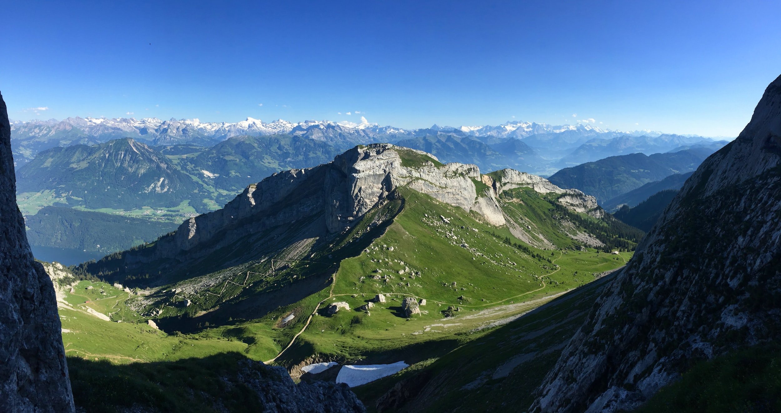
View of the Alps from the summit of Mount Pilatus near Lucerne

Day 7-9: Zurich & Engelberg

Before ending your holiday make sure you spend a few days exploring Zurich - Switzerland's largest city - where you'll be spoiled for choice with things to do such as visiting museums or taking part in some fun outdoor activities! And don’t forget about Engelberg, an easy day trip from Zurich or Lucerne. This mountain resort has some incredible slopes perfect for winter sports enthusiasts or those wanting to simply marvel at their beauty from afar. No matter what type of activity you choose here, it's sure to be an unforgettable experience! For dinner, try some traditional Swiss cuisine at Restaurant Kronenhalle.

Zurich's old town, the Limmat River, and St. Peter's clock tower

With so much beauty waiting around every corner it's no surprise why people come back again and again when they visit Switzerland! Whether it's exploring Geneva's cobblestone streets or admiring views from atop Jungfraujoch – Top Of Europe there are endless memorable moments awaiting travelers who embark on this incredible 9-day journey through this stunning country!


So what are you waiting for? Pack your bags and get ready for an unforgettable Swiss adventure! Contact me to get started today!
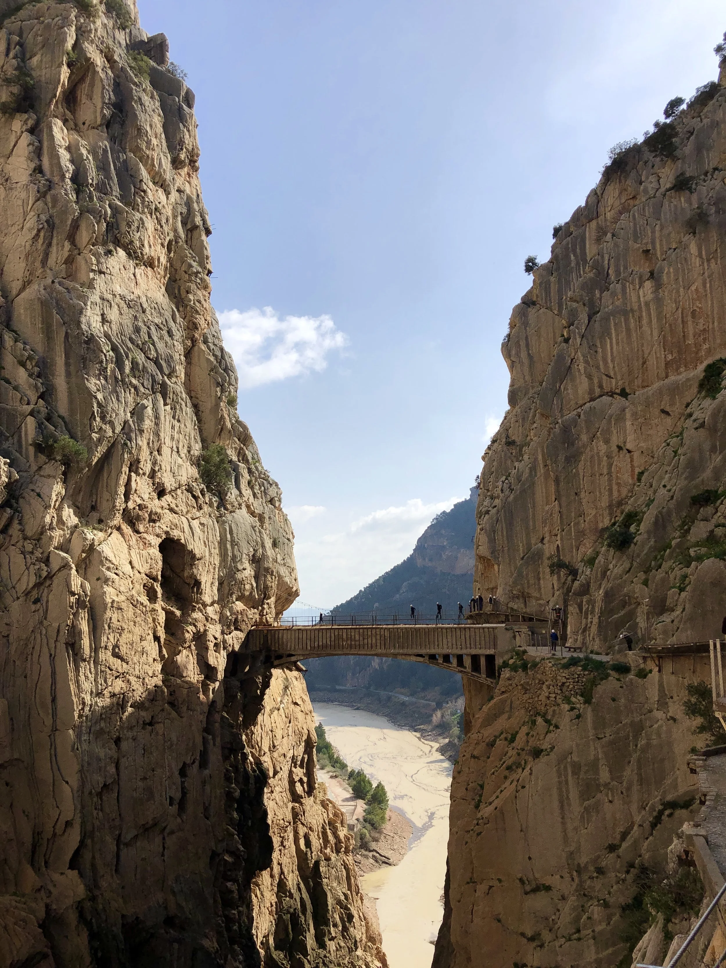
 
A Guide to Visiting Caminito del Rey in Spain
 
Caminito+Del+Rey+Hike

A GUIDE TO VISITING CAMINITO DEL REY IN SPAIN


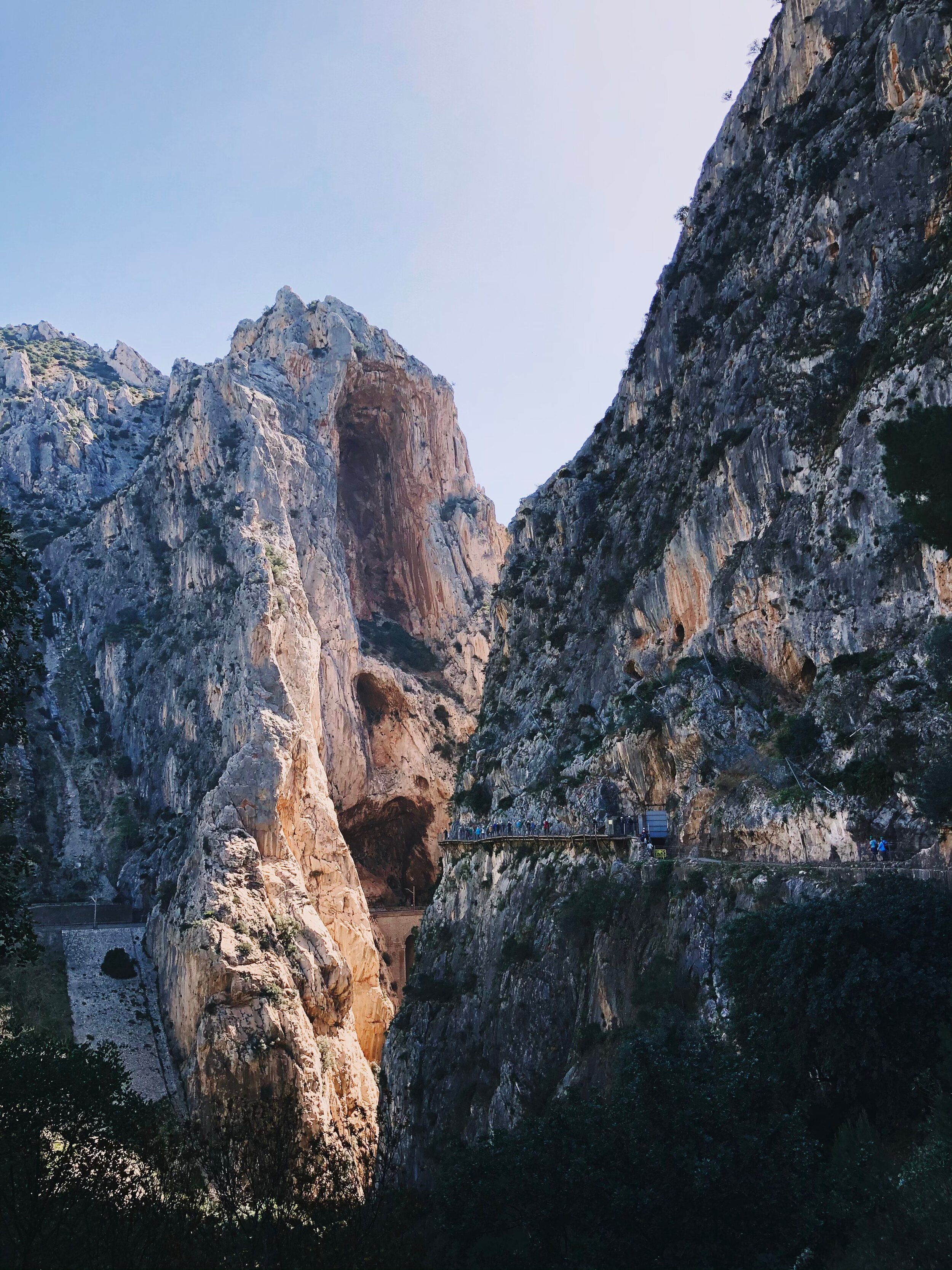
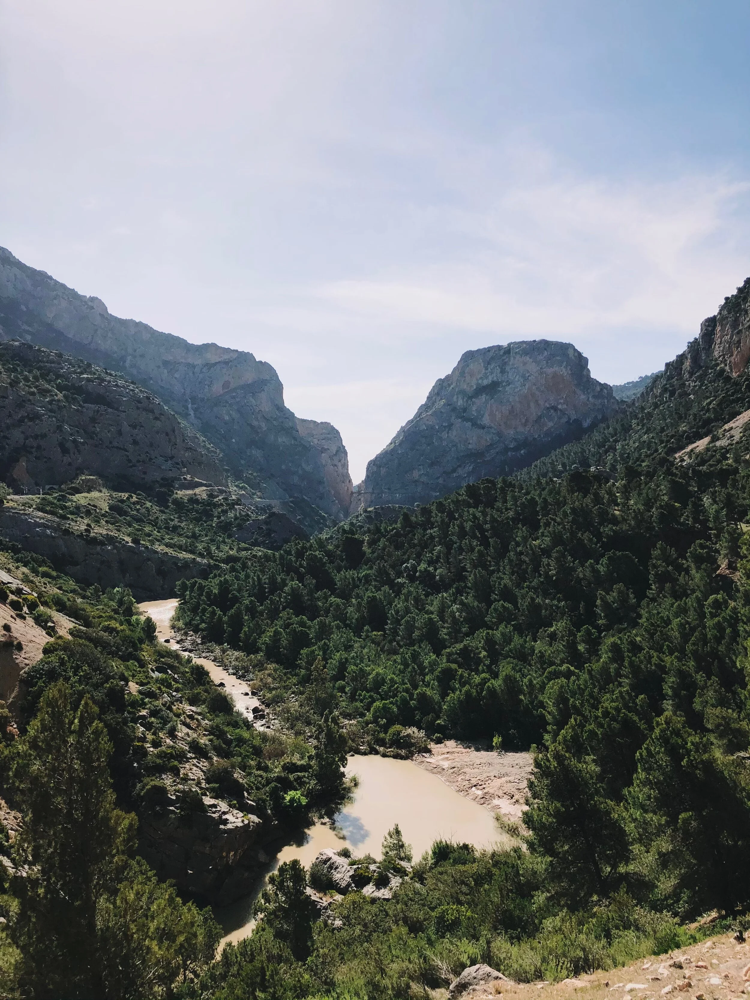
El Caminito del Rey is a walkway, pinned along the steep walls of a narrow gorge in El Chorro, near Ardales in the province of Málaga, Spain. The name derives from the original name of Camino del Rey, abbreviated locally to el caminito. The walkway had fallen into disrepair and was partially closed for over a decade. It was previously known as “the world’s most dangerous hike” following five deaths between 1999 and 2000. The hike reopened in 2015 with a new walkway. [The Rough Guide to Andalucia, 1995]

While doing tons of research on my husband and I’s Spain trip, I came across this hike and knew that we had to do it!

Footbridge spanning the narrow gorge at Caminito del Rey, Spain
Caminito del Rey walkway along the cliffs above the river gorge
 
Boardwalk pinned to the cliff face on the Caminito del Rey hike
 

The path is closed every Monday, and January 1st, December 24th, 25th and 31st December.

The hike is doable year round. The opening hours differ depending on the season: in the winter season (November–March) 10 am to 2 pm; in summer season (April–October) the walkway is open from 10 am to 5 pm. One can enter every 15 to 30 minutes.


Ronda

This beautiful white-washed city is home to the famous Puente Neuvo. Located on a hill-top overlooking a deep gorge, this is one of the most famous of Andalucia's pueblo blancos (white towns). You will not be disappointed in the impressive views if you decide to make this your base camp for the night. I would recommend a stay at Hotel La Fuente de la Higuera which is a converted olive mill with amazing views or for a more luxury property, Hotel Montelirio.

Málaga

Málaga is known to many as the gateway to the Costa del Sol. Having not been here myself, I cannot really recommend it personally, but given the chance, I would definitely love to visit. I would recommend staying at Palacio Solecio, which is a luxury hotel in Málaga.

Antequera

Antequera is a city most known for its ancient burial mounds. Hotel options here include: Finca Eslava and Hotel Convento La Magdalena.


Caminito del rey pano

BY ROAD:

If you travel by road from Málaga through Ardales or Álora:

If you start your trip in Málaga City, take the A–357 motorway and go towards the MA-5403, through the Towns of Cártama, Pizarra, Carratraca, and Ardales. This route is 59.1 km long, and it takes a bit more than 50 minutes by car. In Pizarra, you can also go to Álora by road, and then along the A-343 to El Chorro Train Station. This route is a little bit longer – 60 km, and you will take a little more than one hour to get to your destination. The road is narrower and curvier than the previous one.

Coming from Antequera:

From most points of Andalusia, placed to the north of the El Caminito del Rey, the best way to the trail is coming from Antequera (which is usually accessed by the A-92 motorway). At Antequera, you can choose one of the following two ways:
a) The first one is towards Camplillos (the A-384 motorway), which leads to the reservoirs of El Chorro (A-357 and MA-451) in Ardales. This route is 55 km long and takes about 54 minutes.
b) The other one is from Antequera to Abdalajís Valley (A-343), and then to El Chorro Train Station (MA-4401). This route roads are much narrower, have more curves and their surface is worse. Nevertheless, the way is shorter (34 km long, and you take 45 minutes).

Coming from Ronda:

Finally, you can also arrive at the trail coming from Ronda, along the motorway that stretches from Cadiz (A-367) and goes to Ardales. There you can take the above MA-5403. This route is 60 km long and takes one hour to be crossed.


BY TRAIN:

On 1st February RENFE short-distance trains are starting to run again, offering tickets which include journeys by Train and Bus, and the entrance to El Caminito del Rey

These trains connect Málaga and Seville, but use the road between the stations in Pedrera and Osasuna and the opposite. The rest of the route is along the railway).
• Direction Sevilla-Málaga:
1. Train MD 13900 (34950), which stops at El Chorro station at 10:15 a.m.and  leaves it at 10:24 a.m.
2. Train MD 13904 (33904), which stops at El Chorro stationat 3:49 p.m. and leaves the station at 3:50 p.m.

• Direction Málaga-Sevilla:
1. Train MD 13907, which stops at El Chorro at 4:51 p.m. and leaves the station at 4:52 p.m.

The train that goes from Málaga to Ronda and back keeps using the road and has no station El Chorro-Caminito del Rey.


The above information can be found in detail on Caminito del Rey’s official website - Please check there for any updates to roadways or parking situations.


There are two paths if you come from the surroundings of the Conde de Guadalhorce (the Count of Guadalhorce) Reservoir in Ardales. The first one is shorter and it takes from 20 to 25 minutes. It goes through the smaller lit tunnel, which is placed some 200 m before El Kiosko restaurant, to the control cabin at the Gaitanejo Hydroelectric Power Station. The second path is longer, and it starts at the Chair of Alfonso XIII (this is a signposted downhill path). These 2.7 km can be covered in 50 minutes.

  1. It is 10 minutes distance from the control point to the access to the boardwalks.

  2. Total length of the inland route takes 150 minutes to be crossed: The controlled area: boardwalk – Hoyo Valley – boardwalk.

  3. From the boardwalk exit at El Chorro (Álora) to the control cabin: 15 minutes.

  4. From the control cabin (Álora) to the train station: 15 minutes (the distance from point 4 to 5 is 2.1 km).

When you come to the end of the path, you can take the train or go to your car if you parked it at El Chorro. If not, you should go back to the northern access by shuttle bus or on foot (as mentioned before, this way is rather long and goes along a narrow local road with no hard shoulder at some points).

See full details on the website linked above.

Caminito del Rey

All-in-all, the hike was not strenuous in any respect. The path is mostly flat with a few stairs. I am actually very afraid of heights - if this is you, then I would take a look at photos or watch some videos before attempting this hike. The path is literally suspended to the side of the canyon with a raging river running below you. The views are absolutely breathtaking!

The pathway reopened in 2015 after being closed for several years. When you are walking through the canyon, you can see why! Much of the old path remains below the new one..there are no handrails, many broken boards, among other hazards - you can easily see why this was named as one of the most dangerous hikes to attempt. The Spanish government really did an excellent job repairing this hike and making it as safe as possible to enjoy!


After you have hike the 5 km, you will either need to walk back to your car (which I do NOT recommend - it is very far!) or catch the bus. The bus pickup is a hike in and of itself to be honest. There were several signs that stated “bus stop 300 m”. I feel like this was actually the longest part of the day. The bus ended up being almost a mile from the end of the hike so just keep going when you finish and eventually you will make it.

The bus picks you up and then will drop you off at either of the two restaurants at which point you can either grab a bite to eat or a cold beverage (the cider is wonderful!) and use the toilet before heading to your final destination for the night.


  1. Buy your tickets ahead of time and do not miss your time slot! - We saw several people walk up to the control tower without realizing that they needed to purchase tickets in advance only to be turned away.

  2. Take the shorter path to the start of the hike. If you go through a tunnel and you see a sign that states “Caminito del rey - 2.7 km”, then turn around! If you go out to the main road and walk a little ways down, then you will see another entrance that is a much shorter walk.

  3. I do not think that you need a guide for this hike as the trail is very well marked and there are several employees that are interspersed throughout the trail. If you would like to have a guide, then you can book a guided hike here.


If you’re heading to Spain, don’t miss my How to Plan Your Own Andalusia Spain Trip.

Caminito del Rey
Caminito del rey
 
Caminito del Rey guide graphic showing the hanging footbridge
 

PIN ME FOR LATER

 
Þórsmörk Hiking and Super Jeep Adventure With Southcoast Adventures, Iceland


Dark mountains and a glacier in Þórsmörk valley, Iceland
 

ICELAND - the land of FIRE and ICE. We spent a wonderful and adventurous 9 days in Iceland over Labor Day (You can find the blog post here.)

Our time was filled with numerous hikes, beautiful sunsets, and breathtaking views. One of our most memorable experiences was our day with Southcoast Adventures!


ÞÓRSMÖRK SUPERJEEP ADVENTURE:
Spectacular hiking options and adventurous rides over various un-bridged glacial rivers.

Porsmork superjeef adventure with Southcoast Adventures

Southcoast Adventures Gljúfrabúi base is located down the road from the famous Seljalandsfoss waterfall. There is an amazing campground that is located at this base (Hamragarðar Campsite) that sits below the Gljúfrabúi waterfall. You can park your camper van here for the night while you spend a full day in þórsmörk hiking.

 
Couple hugging at sunset in the Icelandic countryside
 

TIP: Spending the night camping at Hamragarðar Campsite allows you to beat the crowds at Seljalandsfoss and Gljúfrabúi waterfalls

Our Þórsmörk superjeep adventure started first thing in the morning with a 45 minute drive from Gljúfrabúi base to Þórsmörk, which is the site of many trailheads.

The drive to Þórsmörk itself is quite entertaining! You’re fording rivers and going over large rocks down one of Iceland’s F-roads all while spotting glaciers and mountains in the distance.

Glacier and gravel plain in Þórsmörk, Iceland
Braided river winding through Þórsmörk valley below a glacier

We did several hikes during our time in Þórsmörk valley. The main one that we did was part of the Fimmvörðuháls trail. This is the longest of the most popular ‘short hikes’ in the area (around 10km) usually starting in the canyon valley. We started in Húsadalur and made our way to a delicious lunch at Húsadalur at the Volcano Huts cabin. Our guide was Darri and he kept us entertained all day with stories of Icelandic Trolls (The Christmas story was especially entertaining.) and normal day to day life in Iceland.

Two hikers smiling on a trail in Þórsmörk, Iceland
Hiker on a trail with glacier views in Þórsmörk

My husband’s bag was lost for the whole first five days of our trip so we had to cut our hiking day short. Just a heads up, there is no where to buy men’s underwear in Iceland - HaHa! (We finally found some at a local grocery store on night four!)

We had enough time to stop by a small canyon on the way back to Gljúfrabúi base, however. The canyon involves some jumping from rock to rock over a small creek/river. Once inside the canyon, you use this chain that has been bolted into the side of the canyon in order to pull yourself up over a small waterfall to see the much larger waterfall. It was gorgeous!

Hiker inside a narrow mossy canyon in south Iceland
Narrow moss-covered canyon in south Iceland
 
Two hikers in front of a waterfall inside a canyon in Iceland
 

If I could do this trip all over again, I would spend a couple days in Þórsmörk taking in all the sights and doing multiple hiking trails. Everywhere you turn, the views are incredible and all so different. I would have to say this is probably the most favorite hike that I have ever done.


Follow me: @thatblondetravels